Orlando, Florida

Get out of town

Day trips from Palm Bay

17 nearby parks, towns and places to explore, ordered by straight-line distance.

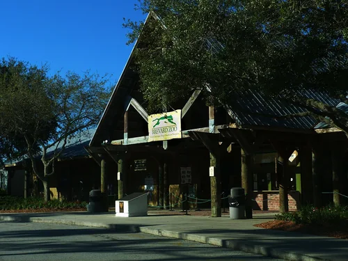
Brevard ZooThings to do

Brevard Zoo

15 miles northwest · straight-line distanceAbout 25 min by car (20 road miles, typical traffic, checked October 2026)

Zoo in Florida, United States.

Confirm the visitor entrance, hours, reservations, access and seasonal conditions. Islands or water destinations may require different transport.
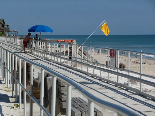
Sebastian Inlet State ParkState park

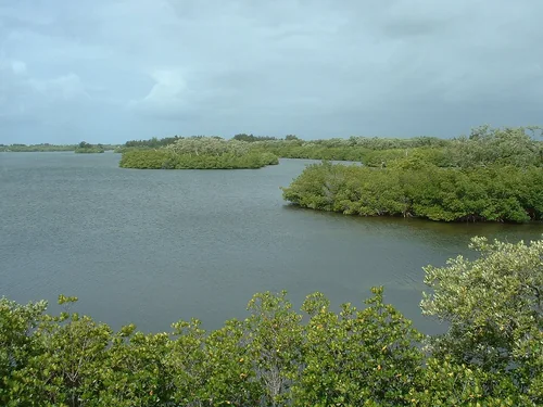
Sebastian Inlet State Park

15 miles southeast · straight-line distance

State park in Florida, US.

Confirm the visitor entrance, hours, reservations, access and seasonal conditions. Islands or water destinations may require different transport.
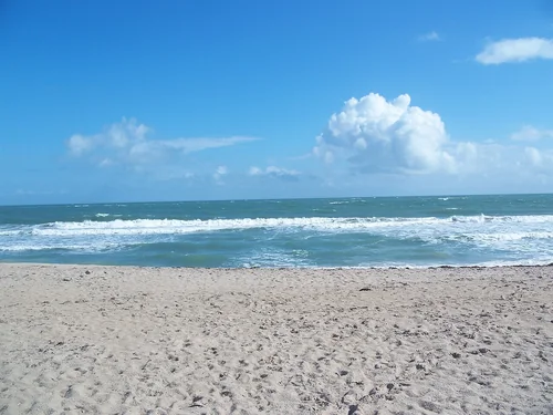
Town

Rockledge

22 miles northwest · straight-line distanceAbout 30 min by car (23 road miles, typical traffic, checked October 2026)

City in Brevard County, Florida, United States of America.

Confirm the visitor entrance, hours, reservations, access and seasonal conditions. Islands or water destinations may require different transport.
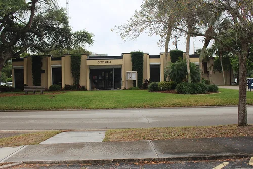
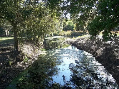
Cape Canaveral City HallTown

Cape Canaveral

24 miles north · straight-line distanceAbout 45 min by car (27 road miles, typical traffic, checked October 2026)

City in Brevard County, Florida, United States.

Confirm the visitor entrance, hours, reservations, access and seasonal conditions. Islands or water destinations may require different transport.
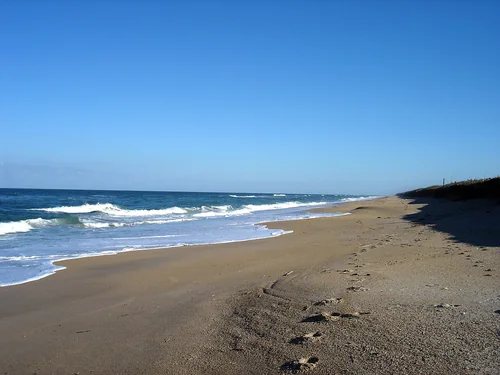
Town

Cocoa

25 miles north · straight-line distanceAbout 35 min by car (26 road miles, typical traffic, checked October 2026)

City in Brevard County, Florida, United States.

Confirm the visitor entrance, hours, reservations, access and seasonal conditions. Islands or water destinations may require different transport.
Vero BeachTown

Vero Beach

29 miles southeast · straight-line distanceAbout 40 min by car (30 road miles, typical traffic, checked October 2026)

County seat of Indian River County, Florida, United States.

Confirm the visitor entrance, hours, reservations, access and seasonal conditions. Islands or water destinations may require different transport.
Ft Pierce FL Avalon SP beach, Avalon State ParkState park

Avalon State Park

38 miles southeast · straight-line distance

State park in Florida, US.

Confirm the visitor entrance, hours, reservations, access and seasonal conditions. Islands or water destinations may require different transport.
Lake Wales FL Lake Kissimmee SP, Lake Kissimmee State ParkState park

Lake Kissimmee State Park

48 miles west · straight-line distance

State park in Florida, United States.

Confirm the visitor entrance, hours, reservations, access and seasonal conditions. Islands or water destinations may require different transport.
Canaveral National SeashoreNational park site

Canaveral National Seashore

52 miles north · straight-line distance

National Seashore in the state of Florida, U.S.

BoatingCampingFishingHikingHorseback ridingPaddlingAgency site ↗

Confirm the visitor entrance, hours, reservations, access and seasonal conditions. Islands or water destinations may require different transport.
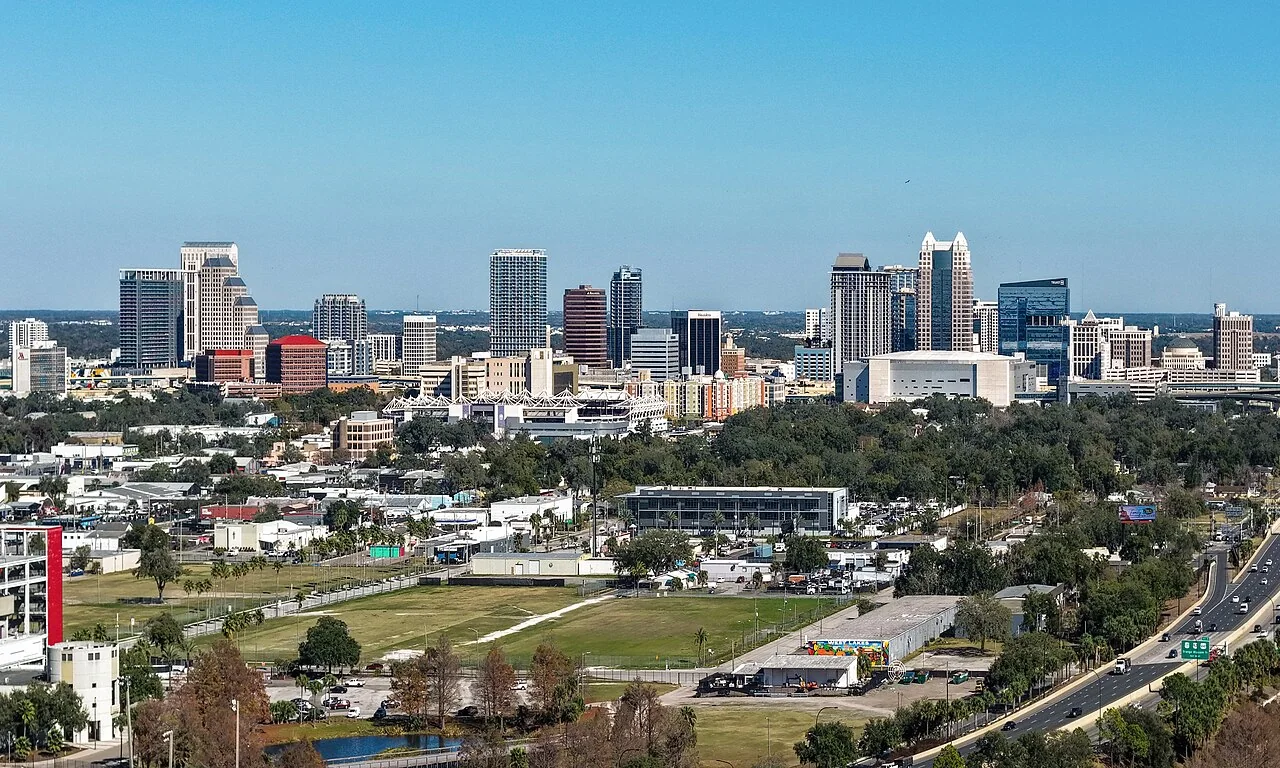
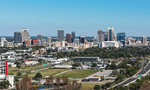
Orlando, FloridaTown

Orlando

60 miles northwest · straight-line distanceAbout 1 hr 15 min by car (76 road miles, typical traffic, checked October 2026)

City in and county seat of Orange County, Florida, United States.

Confirm the visitor entrance, hours, reservations, access and seasonal conditions. Islands or water destinations may require different transport.
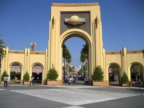
USF Entrance, Universal Studios FloridaThings to do

Universal Studios Florida

62 miles northwest · straight-line distanceAbout 1 hr 20 min by car (80 road miles, typical traffic, checked October 2026)

Theme park in the United States.

Confirm the visitor entrance, hours, reservations, access and seasonal conditions. Islands or water destinations may require different transport.
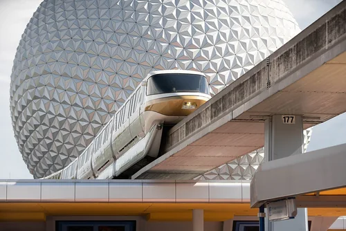
Walt Disney World Epcot Spaceship Earth, Walt Disney World ResortThings to do

Walt Disney World Resort

63 miles west · straight-line distanceAbout 1 hr 30 min by car (87 road miles, typical traffic, checked October 2026)

Resort and entertainment complex in Bay Lake and Lake Buena Vista, Florida, United States.

Confirm the visitor entrance, hours, reservations, access and seasonal conditions. Islands or water destinations may require different transport.

Outdoors

Jupiter Island

75 miles southeast · straight-line distance

Island in Martin County, Florida, United States.

Confirm the visitor entrance, hours, reservations, access and seasonal conditions. Islands or water destinations may require different transport.

Lake

Lake Okeechobee

76 miles south · straight-line distance

Freshwater lake in the state of Florida, USA.

Confirm the visitor entrance, hours, reservations, access and seasonal conditions. Islands or water destinations may require different transport.

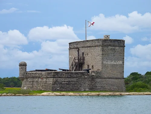
Fort Matanzas river view-2, Fort Matanzas National MonumentNational park site

Fort Matanzas National Monument

123 miles north · straight-line distance

Fort in Florida managed by the National Park Service.

HistoryAgency site ↗

Confirm the visitor entrance, hours, reservations, access and seasonal conditions. Islands or water destinations may require different transport.

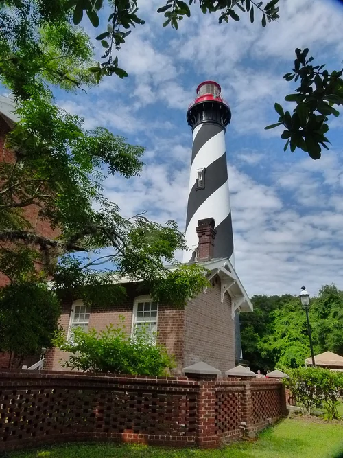
St. Augustine Lighthouse located in Florida, Anastasia IslandOutdoors

Anastasia Island

131 miles north · straight-line distance

Barrier island in St. Johns County, Florida, United States.

Confirm the visitor entrance, hours, reservations, access and seasonal conditions. Islands or water destinations may require different transport.

Bradenton FL DeSoto Natl Mem, De Soto National MemorialNational park site

De Soto National Memorial

131 miles west · straight-line distance

National Memorial of the United States in Bradenton, United States of America.

FishingHistoryPaddlingAgency site ↗

Confirm the visitor entrance, hours, reservations, access and seasonal conditions. Islands or water destinations may require different transport.

Driving times are typical estimates from the city center without live traffic, Powered by Geoapify · © OpenStreetMap contributors.

Distances are measured in a straight line from the city, not by road. Some older drive-time estimates have no reliable date and do not reflect current traffic; routes to large parks or waterfronts may vary. Check the destination entrance before leaving. Place descriptions come from Wikidata. Photo credits include capture dates when available; photos may not show current conditions.

Outdoor places near Palm Bay

30 recreation areas and campgrounds within 132 miles, from Recreation.gov. Filter by what you want to do.

Recreation area

Archie Carr National Wildlife Refuge

12 miles southeast · straight-line distanceFish and Wildlife Service

The Archie Carr National Wildlife Refuge stretches across 20.5 miles of beach and shoreline habitat between Melbourne Beach and Wabasso Beach along Florida's east coast in Brevard and Indian River Counties.

BirdingFishingPhotography

Recreation area

Pelican Island National Wildlife Refuge

18 miles southeast · straight-line distanceFish and Wildlife Service

Pelican Island National Wildlife Refuge (NWR) is situated in the Indian River Lagoon estuary, which runs 156 miles down Florida’s eastern coastline.

BirdingBoatingFishingHikingMotor BoatNature educationNon-Motorized BoatingPhotography

Recreation area

Merritt Island National Wildlife Refuge

43 miles north · straight-line distanceFish and Wildlife Service

The refuge traces its beginnings to the development of the nation’s Space Program. In 1962, NASA acquired the lands and waters adjacent to Cape Canaveral to establish the John F. Kennedy Space Center.

BirdingBoatingFishingHikingHuntingNon-Motorized BoatingPhotographyRanger programs

Recreation area

Canaveral National Seashore

53 miles north · straight-line distanceNational Park Service

Discover a dynamic barrier island shaped by dunes, coastal hammocks, and Mosquito Lagoon. Walk among ancient Timucua shell mounds and connect with thousands of years of human history.

BoatingCampingFishingHikingHorseback ridingPaddlingSwimmingWildlife viewing

Campground

St Lucie South

67 miles south · straight-line distanceAbout 1 hr 20 min by car (82 road miles, checked October 2026)US Army Corps of Engineers

St. Lucie Campground provides a relaxing camping experience on the St. Lucie Canal, part of the 152 mile Okeechobee Waterway that spans South Florida from the Atlantic Ocean to the Gulf of Mexico.

BirdingBoatingCampingCanoeingFishingHiking

Recreation area

Nathaniel P. Reed Hobe Sound National Wildlife Refuge

75 miles southeast · straight-line distanceFish and Wildlife Service

Nathaniel P. Reed Hobe Sound National Wildlife Refuge contains the largest contiguous section of undeveloped beach in Southeastern Florida and is considered one of the most productive sea turtle nesting areas in the Southeastern United…

FishingHikingNature educationPhotographyRanger programsWildlife viewing

Recreation area

Jupiter Inlet Lighthouse Outstanding Natural Area

81 miles south · straight-line distanceBureau of Land Management

The Jupiter Inlet Lighthouse Outstanding Natural Area (ONA) is part of the Bureau of Land Management’s 27-million acre National Conservation Lands; and the only complete unit east of the Mississippi River.

BoatingDivingHikingHistoryNature educationPaddlingPhotographyPicnicking

Campground

River Forest Group Site

83 miles northwest · straight-line distanceAbout 1 hr 40 min by car (103 road miles, checked October 2026)USDA Forest Service

River Forest is a shaded group camping facility on the shores of the St. Johns River in Ocala National Forest.

CampingFishingHiking

Campground

Clearwater Lake Rec Area

88 miles northwest · straight-line distanceAbout 1 hr 55 min by car (119 road miles, checked October 2026)USDA Forest Service

Clearwater Lake Recreation Area offers a quiet getaway along the southeastern edge of the Ocala National Forest, just outside the community of Paisley, Florida.

BikingBoatingCampingCanoeingFishingHikingKayakingMountain Biking

Recreation area

Lake Woodruff National Wildlife Refuge

88 miles northwest · straight-line distanceFish and Wildlife Service

Lake Woodruff National Wildlife Refuge was established in 1964 as a migratory bird refuge to offset losses of wetland habitat that were occurring in central Florida.

BoatingFishingHuntingNature educationPaddlingRanger programs

Recreation area

Lake Okeechobee

90 miles south · straight-line distanceUS Army Corps of Engineers

As lake, waterway and surrounding countryside, Okeechobee shows the many faces of Florida. A canopy of moss-draped live oaks hides clusters of sabal palms. A tangle of water plants marks the boundary where wetland meets lakeshore.

BoatingCampingFishingHikingHotel/Lodge/Resort Privately OwnedNature educationPicnickingWater sports

Campground

Lake Dorr Cabin

91 miles northwest · straight-line distanceAbout 2 hr 40 min by car (121 road miles, checked October 2026)USDA Forest Service

Lake Dorr Cabin is set along the south shore of beautiful Lake Dorr, ideal for a family getaway. The cabin is open year-round and creates a great setting for plenty of outdoor water fun.

BikingBoatingCampingCanoeingFishingHikingSwimming

Campground

Alexander Springs Recreation Area

94 miles northwest · straight-line distanceAbout 2 hr 10 min by car (132 road miles, checked October 2026)USDA Forest Service

Alexander Springs Recreation Area is located in the Ocala National Forest near the beautiful, turquoise waters of Alexander Springs.

BikingBoatingCampingCanoeingFishingHikingKayakingSwimming

Campground

Ortona South

97 miles southwest · straight-line distanceAbout 3 hr 5 min by car (173 road miles, checked October 2026)US Army Corps of Engineers

Ortona South is a perfect campground for a quiet, sunny escape to South Florida. The campground is set along the Caloosahatchie River.

BikingBirdingCampingFishing

Campground

Buck Lake Group Campground

98 miles northwest · straight-line distanceAbout 2 hr 20 min by car (131 road miles, checked October 2026)USDA Forest Service

Buck Lake is a group camping facility in the heart of Ocala National Forest in Florida. Great for family reunions and social gatherings, the campground can host a group of up to 50 guests along the shores of Buck Lake.

BoatingCampingFishingHiking

Campground

Big Scrub Campground

100 miles northwest · straight-line distanceAbout 2 hr 35 min by car (139 road miles, checked October 2026)USDA Forest Service

Perennially popular with off-road vehicle enthusiasts, Big Scrub Campground sits in the Ocala National Forest in central Florida. A trailhead within the facility offers riders campsite-to-trail access.

CampingPicnickingWildlife viewing

Campground

Doe Lake Group Site

102 miles northwest · straight-line distanceAbout 2 hr 15 min by car (135 road miles, checked October 2026)USDA Forest Service

Doe Lake is a group campsite with a variety of activities. Centered around a historic lodge with a large group kitchen, it's an ideal place for major outdoor gatherings of up to 250 people.

CampingFishingHorseback ridingWildlife viewing

Campground

Juniper Springs Rec Area

105 miles northwest · straight-line distanceAbout 2 hr 10 min by car (135 road miles, checked October 2026)USDA Forest Service

Juniper Springs Campground is one of the most popular campgrounds in the Ocala National Forest. The location offers deeply shaded sites within walking distance of some of Florida's most beautiful natural springs.

BoatingCampingFishingHikingHistoryRanger programsSwimmingWater sports

Recreation area

Arthur R. Marshall Loxahatchee National Wildlife Refuge

109 miles south · straight-line distanceFish and Wildlife Service

The Loxahatchee National Wildlife Refuge was established in 1951 under the authority of the Migratory Bird Conservation Act of 1929 with a 50-year license agreement between the State of Florida and the U.S.

BikingBirdingBoatingEducational ProgramsFishingHikingHorseback ridingHunting

Campground

Mill Dam Group Camp

109 miles northwest · straight-line distanceAbout 2 hr 20 min by car (142 road miles, checked October 2026)USDA Forest Service

Mill Dam Group Campground offers a fun and relaxing setting for groups of up to 150 to enjoy Ocala National Forest.

CampingHikingSwimmingWater sports

Campground

W.P. Franklin N

113 miles southwest · straight-line distanceAbout 2 hr 55 min by car (167 road miles, checked October 2026)US Army Corps of Engineers

Visitors flock to W.P. Franklin Campground for its well-kept facilities and location on the Caloosahatchee River, where campers can fish, boat and take it easy in sunny southwest Florida.

BirdingBoatingCampingFishingKayaking

Campground

W.P. Franklin South Recreation Area

113 miles southwest · straight-line distanceAbout 2 hr 50 min by car (166 road miles, checked October 2026)US Army Corps of Engineers

WP Franklin South Recreation Area is a day use area located on the Caloosahatchee River adjacent to the WP Franklin Lock and Dam.

BoatingCampingCanoeingFishingKayakingPicnicking

Campground

Salt Springs Recreation Area

115 miles northwest · straight-line distanceAbout 2 hr 30 min by car (147 road miles, checked October 2026)USDA Forest Service

Salt Springs Recreation Area is one the recreational jewels of the Ocala National Forest, with a spectacular natural mineral spring that gives the area its name.

BoatingCampingCanoeingFishingHikingSwimming

Recreation area

Caloosahatchee National Wildlife Refuge

118 miles southwest · straight-line distanceFish and Wildlife Service

The refuge was established by President Woodrow Wilson on July 1, 1920, through Executive Order 3299 as a ". . . preserve and breeding ground for native birds" upon the recommendation of Thomas and Mina Edison.

Boating

Campground

Lake Shore Group Camp

118 miles northwest · straight-line distanceAbout 2 hr 35 min by car (155 road miles, checked October 2026)USDA Forest Service

Lake Shore Group Campground sits on the north shore of Fore Lake in Ocala National Forest. It is a favorite for scout, church and civic groups, as well as large families and reunions.

CampingFishingHikingPicnicking

Recreation area

Guana Tolomato Matanzas National Estuarine Research Reserve

119 miles north · straight-line distanceNational Oceanic and Atmospheric Administration

The Guana Tolomato Matanzas National Estuarine Research Reserve encompasses approximately 55,000 acres of salt marsh and mangrove tidal wetlands, oyster bars, estuarine lagoons, upland habitat and offshore seas in Northeast Florida.

PaddlingPhotographyRanger programsSwimmingWildlife viewing

Recreation area

Fort Matanzas National Monument

122 miles north · straight-line distanceNational Park Service

Fort Matanzas National Monument preserves the fortified coquina watchtower, completed in 1742, which defended the southern approach to the Spanish military settlement of St. Augustine.

History

Recreation area

De Soto National Memorial

130 miles west · straight-line distanceNational Park Service

In May 1539, Conquistador Hernando de Soto’s army of soldiers, hired mercenaries, craftsmen, and clergy made landfall in Tampa Bay. They were met with fierce resistance of indigenous people protecting their homelands.

FishingHistoryPaddling

Campground

Gator Head Campground

132 miles south · straight-line distanceAbout 4 hr 10 min by car (197 road miles, checked October 2026)National Park Service

Gator Head Campground is a primitive campground located within the Bear Island Unit of Big Cypress National Preserve.

BikingBirdingCampingFishingOff Road Vehicle TrailsWildlife viewing

Recreation area

Island Bay National Wildlife Refuge

132 miles southwest · straight-line distanceFish and Wildlife Service

On the refuge, beaches and shores of the refuge provide loafing and feeding sites for shorebirds, gulls, and terns. The surrounding shallow bays provide valuable feeding areas for the wading and water birds.

BoatingPaddling

Recreation areas and campgrounds from Recreation.gov's directory, checked October 9, 2026. Listings are not live availability: check Recreation.gov or the managing agency for open dates, fees, reservations and conditions. Directions go to the listed coordinates, which may not be the entrance. Campground driving times: Powered by Geoapify · © OpenStreetMap contributors.

Questions

What day-trip ideas are near Palm Bay?

This guide includes Brevard Zoo, Sebastian Inlet State Park, Rockledge, Cape Canaveral, Cocoa. Places are ordered by straight-line distance. Confirm visitor access, opening hours and current travel conditions before choosing a trip.

How far is Brevard Zoo from Palm Bay?

Approximately 15 miles northwest in a straight line; driving takes about 25 min over 20 road miles in typical traffic (Geoapify, checked October 2026). This is not current traffic or a route to a confirmed visitor entrance. Check your route before leaving.

How far is Sebastian Inlet State Park from Palm Bay?

Approximately 15 miles southeast in a straight line. This is not current traffic or a route to a confirmed visitor entrance. Check your route before leaving.

How far is Rockledge from Palm Bay?

Approximately 22 miles northwest in a straight line; driving takes about 30 min over 23 road miles in typical traffic (Geoapify, checked October 2026). This is not current traffic or a route to a confirmed visitor entrance. Check your route before leaving.

Where can I camp near Palm Bay?

Recreation.gov lists 16 campgrounds within 132 miles, including St Lucie South (67 miles south), River Forest Group Site (83 miles northwest), Clearwater Lake Rec Area (88 miles northwest). Check Recreation.gov for current availability, seasons and reservations.

Palm Bay AI

Your Palm Bay local guide
Hey there!

I'm Palm Bay AI. Ask about local food, shopping, history or a day out.

AI recommendations may be inaccurate. Verify hours and prices. Questions are processed by Cloudflare. Privacy