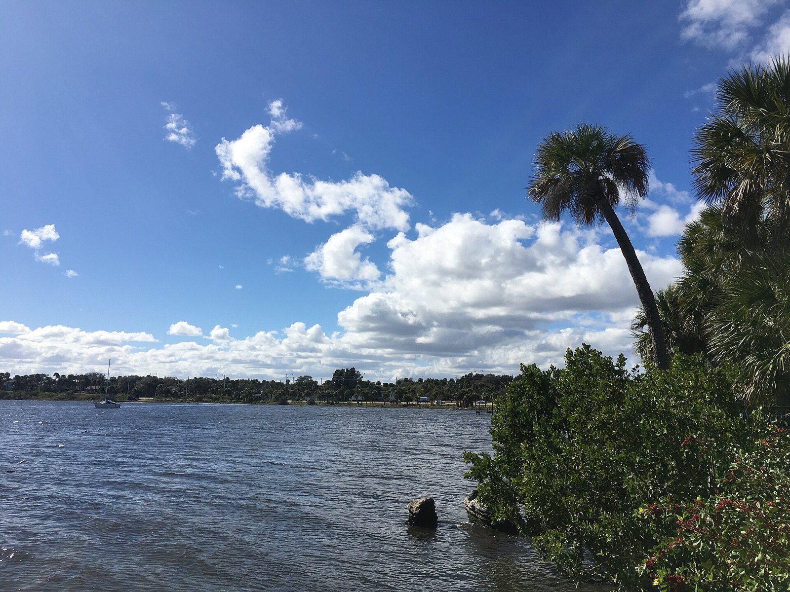
Palm Bay city view

Outdoors

Fishing near Palm Bay

Lakes, rivers and recreation areas near Palm Bay where fishing is allowed, closest first.

23places to fish
12 mito the closest
2within 30 miles

Good to know: Anyone 16 or older generally needs a state fishing license; seasons, limits and special rules vary by water. Florida license information ↗

Closest picks

1

Archie Carr National Wildlife Refuge

12 mi southeast · Fish and Wildlife Service

The Archie Carr National Wildlife Refuge stretches across 20.5 miles of beach and shoreline habitat between Melbourne Beach and Wabasso Beach along Florida's east coast in Brevard and Indian River Counties.
2

Pelican Island National Wildlife Refuge

18 mi southeast · Fish and Wildlife Service

Pelican Island National Wildlife Refuge (NWR) is situated in the Indian River Lagoon estuary, which runs 156 miles down Florida’s eastern coastline.

3

Merritt Island National Wildlife Refuge

43 mi north · Fish and Wildlife Service

The refuge traces its beginnings to the development of the nation’s Space Program. In 1962, NASA acquired the lands and waters adjacent to Cape Canaveral to establish the John F. Kennedy Space Center.

Map of all 23 places

Map of 23 places loads as you scroll.

Within 30 miles (2)

12 mi southeast · Fish and Wildlife Service

Archie Carr National Wildlife Refuge

The Archie Carr National Wildlife Refuge stretches across 20.5 miles of beach and shoreline habitat between Melbourne Beach and Wabasso Beach along Florida's east coast in Brevard and Indian River Counties.

  • Birding
  • Fishing
  • Photography

18 mi southeast · Fish and Wildlife Service

Pelican Island National Wildlife Refuge

Pelican Island National Wildlife Refuge (NWR) is situated in the Indian River Lagoon estuary, which runs 156 miles down Florida’s eastern coastline.

  • Birding
  • Boating
  • Fishing
  • Hiking
  • Motor Boat
  • Nature education
  • Non-Motorized Boating
  • Photography

30 to 75 miles (4)

43 mi north · Fish and Wildlife Service

Merritt Island National Wildlife Refuge

The refuge traces its beginnings to the development of the nation’s Space Program. In 1962, NASA acquired the lands and waters adjacent to Cape Canaveral to establish the John F. Kennedy Space Center.

  • Birding
  • Boating
  • Fishing
  • Hiking
  • Hunting
  • Non-Motorized Boating
  • Photography
  • Ranger programs

53 mi north · National Park Service

Canaveral National Seashore

Discover a dynamic barrier island shaped by dunes, coastal hammocks, and Mosquito Lagoon. Walk among ancient Timucua shell mounds and connect with thousands of years of human history.

  • Boating
  • Camping
  • Fishing
  • Hiking
  • Horseback riding
  • Paddling
  • Swimming
  • Wildlife viewing

67 mi south · US Army Corps of Engineers · Campground

St Lucie South

St. Lucie Campground provides a relaxing camping experience on the St. Lucie Canal, part of the 152 mile Okeechobee Waterway that spans South Florida from the Atlantic Ocean to the Gulf of Mexico.

  • Birding
  • Boating
  • Camping
  • Canoeing
  • Fishing
  • Hiking

75 mi southeast · Fish and Wildlife Service

Nathaniel P. Reed Hobe Sound National Wildlife Refuge

Nathaniel P. Reed Hobe Sound National Wildlife Refuge contains the largest contiguous section of undeveloped beach in Southeastern Florida and is considered one of the most productive sea turtle nesting areas in the Southeastern United…

  • Fishing
  • Hiking
  • Nature education
  • Photography
  • Ranger programs
  • Wildlife viewing

75 miles and farther (17)

83 mi northwest · USDA Forest Service · Campground

River Forest Group Site

River Forest is a shaded group camping facility on the shores of the St. Johns River in Ocala National Forest.

  • Camping
  • Fishing
  • Hiking

88 mi northwest · USDA Forest Service · Campground

Clearwater Lake Rec Area

Clearwater Lake Recreation Area offers a quiet getaway along the southeastern edge of the Ocala National Forest, just outside the community of Paisley, Florida.

  • Biking
  • Boating
  • Camping
  • Canoeing
  • Fishing
  • Hiking
  • Kayaking
  • Mountain Biking

88 mi northwest · Fish and Wildlife Service

Lake Woodruff National Wildlife Refuge

Lake Woodruff National Wildlife Refuge was established in 1964 as a migratory bird refuge to offset losses of wetland habitat that were occurring in central Florida.

  • Boating
  • Fishing
  • Hunting
  • Nature education
  • Paddling
  • Ranger programs

90 mi south · US Army Corps of Engineers

Lake Okeechobee

As lake, waterway and surrounding countryside, Okeechobee shows the many faces of Florida. A canopy of moss-draped live oaks hides clusters of sabal palms. A tangle of water plants marks the boundary where wetland meets lakeshore.

  • Boating
  • Camping
  • Fishing
  • Hiking
  • Hotel/Lodge/Resort Privately Owned
  • Nature education
  • Picnicking
  • Water sports

91 mi northwest · USDA Forest Service · Campground

Lake Dorr Cabin

Lake Dorr Cabin is set along the south shore of beautiful Lake Dorr, ideal for a family getaway. The cabin is open year-round and creates a great setting for plenty of outdoor water fun.

  • Biking
  • Boating
  • Camping
  • Canoeing
  • Fishing
  • Hiking
  • Swimming

94 mi northwest · USDA Forest Service · Campground

Alexander Springs Recreation Area

Alexander Springs Recreation Area is located in the Ocala National Forest near the beautiful, turquoise waters of Alexander Springs.

  • Biking
  • Boating
  • Camping
  • Canoeing
  • Fishing
  • Hiking
  • Kayaking
  • Swimming

97 mi southwest · US Army Corps of Engineers · Campground

Ortona South

Ortona South is a perfect campground for a quiet, sunny escape to South Florida. The campground is set along the Caloosahatchie River.

  • Biking
  • Birding
  • Camping
  • Fishing

98 mi northwest · USDA Forest Service · Campground

Buck Lake Group Campground

Buck Lake is a group camping facility in the heart of Ocala National Forest in Florida. Great for family reunions and social gatherings, the campground can host a group of up to 50 guests along the shores of Buck Lake.

  • Boating
  • Camping
  • Fishing
  • Hiking

102 mi northwest · USDA Forest Service · Campground

Doe Lake Group Site

Doe Lake is a group campsite with a variety of activities. Centered around a historic lodge with a large group kitchen, it's an ideal place for major outdoor gatherings of up to 250 people.

  • Camping
  • Fishing
  • Horseback riding
  • Wildlife viewing

105 mi northwest · USDA Forest Service · Campground

Juniper Springs Rec Area

Juniper Springs Campground is one of the most popular campgrounds in the Ocala National Forest. The location offers deeply shaded sites within walking distance of some of Florida's most beautiful natural springs.

  • Boating
  • Camping
  • Fishing
  • Hiking
  • History
  • Ranger programs
  • Swimming
  • Water sports

109 mi south · Fish and Wildlife Service

Arthur R. Marshall Loxahatchee National Wildlife Refuge

The Loxahatchee National Wildlife Refuge was established in 1951 under the authority of the Migratory Bird Conservation Act of 1929 with a 50-year license agreement between the State of Florida and the U.S.

  • Biking
  • Birding
  • Boating
  • Educational Programs
  • Fishing
  • Hiking
  • Horseback riding
  • Hunting

113 mi southwest · US Army Corps of Engineers · Campground

W.P. Franklin N

Visitors flock to W.P. Franklin Campground for its well-kept facilities and location on the Caloosahatchee River, where campers can fish, boat and take it easy in sunny southwest Florida.

  • Birding
  • Boating
  • Camping
  • Fishing
  • Kayaking

113 mi southwest · US Army Corps of Engineers · Campground

W.P. Franklin South Recreation Area

WP Franklin South Recreation Area is a day use area located on the Caloosahatchee River adjacent to the WP Franklin Lock and Dam.

  • Boating
  • Camping
  • Canoeing
  • Fishing
  • Kayaking
  • Picnicking

115 mi northwest · USDA Forest Service · Campground

Salt Springs Recreation Area

Salt Springs Recreation Area is one the recreational jewels of the Ocala National Forest, with a spectacular natural mineral spring that gives the area its name.

  • Boating
  • Camping
  • Canoeing
  • Fishing
  • Hiking
  • Swimming

118 mi northwest · USDA Forest Service · Campground

Lake Shore Group Camp

Lake Shore Group Campground sits on the north shore of Fore Lake in Ocala National Forest. It is a favorite for scout, church and civic groups, as well as large families and reunions.

  • Camping
  • Fishing
  • Hiking
  • Picnicking

130 mi west · National Park Service

De Soto National Memorial

In May 1539, Conquistador Hernando de Soto’s army of soldiers, hired mercenaries, craftsmen, and clergy made landfall in Tampa Bay. They were met with fierce resistance of indigenous people protecting their homelands.

  • Fishing
  • History
  • Paddling

132 mi south · National Park Service · Campground

Gator Head Campground

Gator Head Campground is a primitive campground located within the Bear Island Unit of Big Cypress National Preserve.

  • Biking
  • Birding
  • Camping
  • Fishing
  • Off Road Vehicle Trails
  • Wildlife viewing

Distances are straight-line miles from downtown Palm Bay. Listings come from Recreation.gov’s federal recreation database; check each official page for hours, fees, fire restrictions and closures before you go.

Get outside around Palm Bay

Around Palm Bay

Another view of Turkey Creek, Turkey Creek Sanctuary, Palm Bay, Florida
Another view of Turkey Creek, Turkey Creek Sanctuary, Palm Bay, FloridaPokemonprime · CC BY 4.0
Juan Ponce de León Landing Park Sign, Palm Bay
Juan Ponce de León Landing Park SignGreaterPonce665 · CC BY-SA 4.0
Palm Bay city hall in Palm Bay, Florida
PalmBayFLCityHallExcel23 · CC BY-SA 4.0

More outdoors near Palm Bay

Questions

Where is the closest place for fishing near Palm Bay?

Archie Carr National Wildlife Refuge (Fish and Wildlife Service), about 12 miles southeast of Palm Bay as the crow flies. Next are Pelican Island National Wildlife Refuge (18 mi) and Merritt Island National Wildlife Refuge (43 mi).

Do I need a fishing license near Palm Bay?

Yes, anglers 16 and older generally need a Florida fishing license from the state wildlife agency. Rules, seasons and limits vary by water.

Who manages these places?

Federal agencies including USDA Forest Service, Fish and Wildlife Service, US Army Corps of Engineers. Each listing links to its official page for hours, fees, closures and current conditions.

Palm Bay AI

Your Palm Bay local guide
Hey there!

I'm Palm Bay AI. Ask about local food, shopping, history or a day out.

AI recommendations may be inaccurate. Verify hours and prices. Questions are processed by Cloudflare. Privacy